

Saba is located at Latitude 17º 38′ North, Longitude 63º 14′ West.
Admiralty Chart
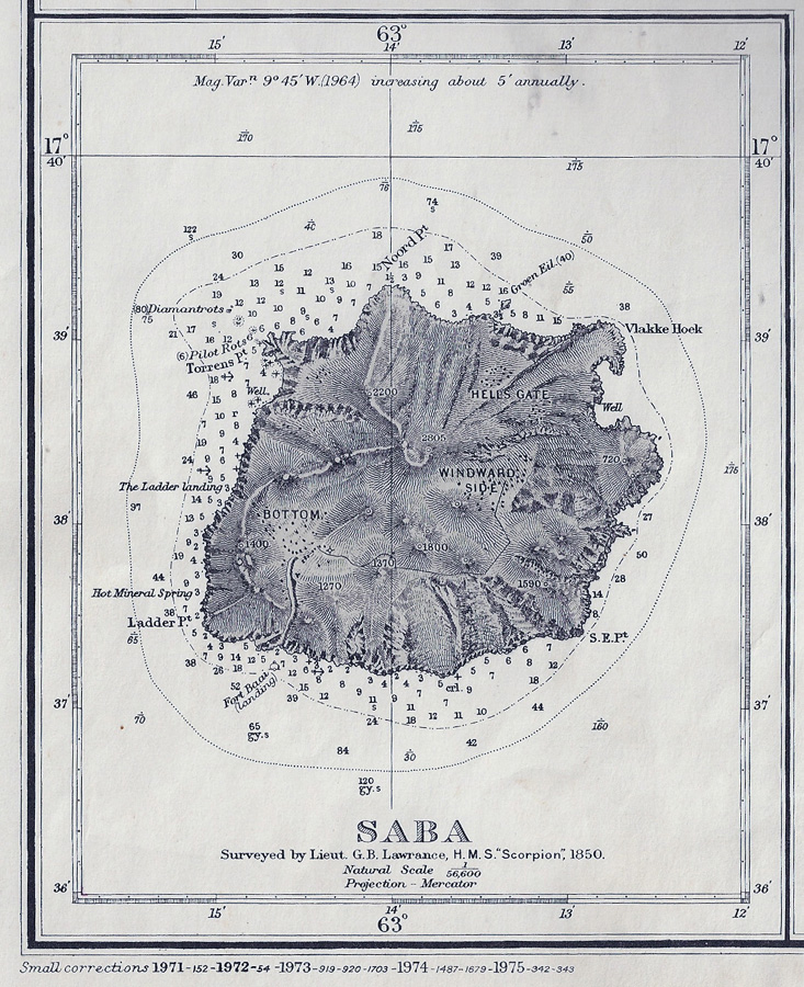
This old British Admiralty Chart has a beautiful rendering of Saba. It’s based on an 1850 survey by the HMS Scorpion, though it’s been updated through 1975. Click the image for a bigger version.
Another Wonderful Saba Map

Saba National Marine Park dive sites map